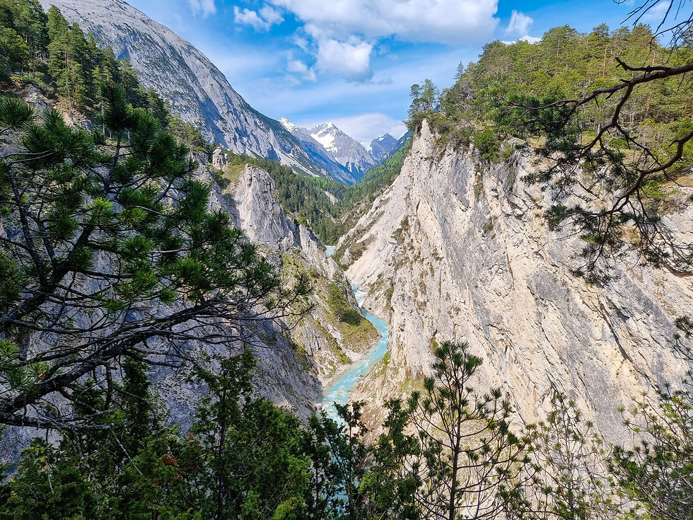
The Region Seefeld in Tirol, Austria, offers a wide range of hiking opportunities, from easy walks around the Wildsee and Reither Moor to more challenging mountain trails with breathtaking views.
In the spring, the region comes alive with wildflowers and greenery, making it an ideal time for walking and exploring the region's many trails.

The village of Scharnitz is located on the border with Bavaria at the end of a widening valley where the Karwendel Valley, Hinterautal and Gleirschtal meet the Isar Valley. The village was once an important commercial route between Germany and Italy.
The site where the town is located today was described in the 8th century AD. as 'wild, desolate, buried under heavy snows all winter: a frightful place', receiving the nickname 'solitudo Scrantiensis' or 'scarace' or even 'scaratie desertum'. The word root ‘scar’ is thought to stem from ancient Illyrian and means ‘naked rock’.
When a road was built by the Romans from Teriolis (today Zirl) to Parthanum (today Partenkirchen, in Germany), they recognised that the narrow valley passage near what today is the village of Scharnitz was an area of great strategic importance.Therefore, they erected a castle named ‘Mansio Scarbia’. It served the Romans as quarters for troops, as well as a coaching inn and posting house.
In A.D. 763, the Bavarian noblemen Reginbert and Irminfrid were ordered by the Bishop of Freising, with the approval of their dukes, to establish in the wilderness a ‘solitudine Scarantiensi’ – the Scaraza Monastery, also known as Scarantia - together with a church dedicated to St. Peter. Several official documents indicate that, during the 14th and 15th centuries, the entire region, extending from what today is Garmisch-Partenkirchen all the way to Zirl, was known as ‘the Scharnitz Woods’, or simply, ‘the Scharnitz’.
Scharnitz is known as "the gateway to the Karwendel", Austria's largest nature park.
A Panoramic hike of approximately 3 hours (7.5 Kilometers) with no technical difficulties, accessible for families.
The trail starts at the eye-catching modern building Scharnitz Nature Park Info Center (open from May 1).

From there follow the Hinterautal road for approx. 1 km to the gravel works. At the gravel works, turn left onto a small path towards the Karwendel Valley, which leads upwards in many serpentines to the forest road and offers wonderful views of the Karwendel Gorge (Karwendelschlucht).
Continue on this road to the right in the direction of the Karwendelhaus. If you want, after a good stretch you can make a small detour to the left to the Birzel chapel.

Otherwise, continue on the forest road until you reach the turnoff to the Karwendelsteg on the right. When the Karwendelbach rushes, the "Karwendelsteg" circular trail leads ever-so-slightly up and down to the Jausenplatz with a view of the Golden Waterfall of the Karwendel Stream worth seeing.

You continue to follow this path until you reach the forest road towards Scharnitz to the right. The last two km via the road back to Scharnitz or shortly after the gravel works to the left over the Isar bridge and further to the right via the Isarsteig back to the starting point.
On the way back you will be rewarded with breathtaking views of the Karwendel gorge and the surrounding mountains.
For more information on hiking trails in Seefeld, you can visit the official website, which provides detailed maps and descriptions of various trails, including their starting points, lengths, elevations, and difficulty ratings.


Comments